
Today, Southern Maine is known for sandy beaches, lobster rolls, lighthouses, coastal walks, bustling downtowns, and some of New England’s most popular vacation destinations.
But long before visitors came for weekends in Ogunquit or summers in Kennebunkport, shipbuilding, fishing, international trade, wars, art, theater, industry, and tourism shaped the communities along this stretch of Maine coast.
Kittery built warships. York became one of Maine’s earliest centers of government. Wells survived as a frontier settlement. Kennebunk and Kennebunkport sent locally built ships around the world. And artists helped transform Ogunquit from a fishing village into a nationally recognized arts destination.
Here are some of the people, industries, and historic events that helped put six Southern Maine towns on the map.
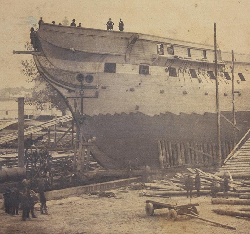
Kittery: Where Maine – and American Naval History – Begins
If you want to start at the beginning, Kittery is a pretty appropriate place.
Incorporated in 1647, Kittery is Maine’s oldest incorporated town. Its original boundaries were enormous, encompassing land that eventually became Eliot, Berwick, North Berwick, and South Berwick. With its location along the Piscataqua River and easy access to the Atlantic, trading and shipbuilding quickly became important parts of the local economy.
Kittery’s biggest historical contribution, however, may be its connection to the United States Navy.
During the American Revolution, Kittery built ships including the Ranger, famously commanded by John Paul Jones. Then, in 1800, the federal government established the Portsmouth Naval Shipyard on what is now Seavey Island in Kittery. The Navy describes it as the nation’s oldest continuously operating naval shipyard.
The shipyard launched its first vessel, the USS Washington, in 1814. It later became particularly important for submarine construction and repair. During World War II, the yard produced submarines at a remarkable pace for the war effort.
Kittery is also connected to one of the Navy’s great tragedies. The Kittery-built nuclear submarine USS Thresher was lost during deep-diving tests in 1963 with all 129 people aboard.
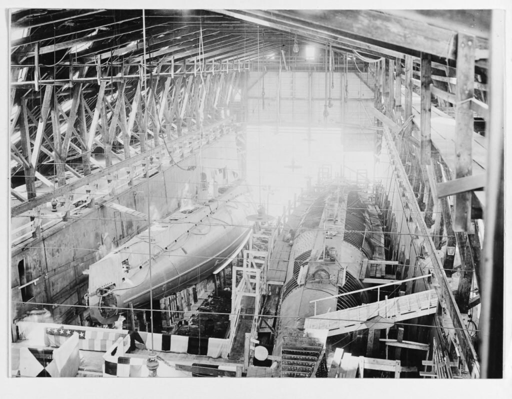
What put Kittery on the map?
Its strategic location, shipbuilding industry, and more than two centuries of American naval history.
Today, you can still see that military heritage around town, while Kittery has added another claim to fame: its outlets, restaurants, and thriving Kittery Foreside.
York: One of Maine’s Oldest Communities and the Site of a Devastating 1692 Attack
York’s history reaches back nearly four centuries.
Originally known as Agamenticus and later Gorgeana, the community eventually became York. By the mid-1600s, it was an important center of colonial life in what would become Maine.
One surviving reminder of that era is the Old Gaol. Maine’s first provincial prison was constructed on Gaol Hill in 1656. A later stone-walled prison was built there beginning in 1719, and the surviving complex offers a fascinating, and sometimes grim, look at colonial justice.
But one event in particular has remained part of York’s historical identity for more than three centuries.
On January 25, 1692, during King William’s War, Indigenous war parties attacked the English settlement at York. The event, historically known as the Candlemas Attack, resulted in deaths and the taking of numerous captives who were brought north toward Canada.
It was part of a much larger and complicated struggle involving European colonial powers and Indigenous nations throughout the Northeast. For settlements along Maine’s frontier, the conflicts repeatedly brought destruction, displacement, and loss.
Yet York endured and grew.
Over the centuries, the community evolved from a colonial settlement and agricultural center into a major seaside destination.
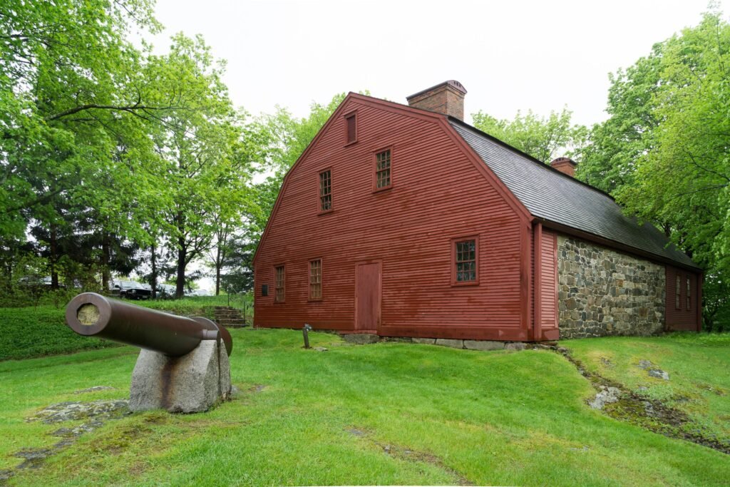
What put York on the map?
Its importance as one of Maine’s earliest colonial communities and its remarkably well-preserved history.
Today, that history lives alongside a very different set of York icons: Long Sands, Short Sands, and Cape Neddick’s Nubble Lighthouse.
Ogunquit: The Fishing Village That Became an American Art Colony
Ogunquit’s path to fame differed from its neighbors’.
The community developed around farming, fishing, and the little harbor at Perkins Cove. But by the end of the 19th century, another group was discovering the dramatic coastline: artists.
Painter and teacher Charles Woodbury purchased property overlooking Perkins Cove in 1896 and began offering summer art classes in 1898. His school attracted students from New England and New York and helped transform Ogunquit into a major American art colony.
Artist and patron Hamilton Easter Field later established another important artistic community. He purchased old fishing shacks around Perkins Cove and made them available to artists and students at low cost. The resulting art community became associated with key developments in American Modernism.
Artists, collectors, and visitors began coming to Ogunquit in increasing numbers, and word spread about the beautiful little seaside town.
The legacy ultimately led to the Ogunquit Museum of American Art, founded by artist Henry Strater and opened in 1953. The museum remains closely connected to the two influential art communities that flourished here.
Then came another cultural institution that would make Ogunquit famous far beyond Maine.
In 1933, Walter and Maude Hartwig founded the Ogunquit Playhouse in a downtown garage. The current theater was built on Main Street in 1937, and over the decades its stage has welcomed generations of Broadway and Hollywood performers.
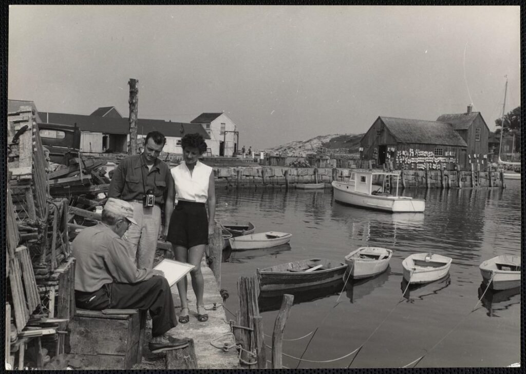
What put Ogunquit on the map?
Its extraordinary combination of natural beauty, art, and live theater.
The beaches brought visitors, but artists and performers helped give Ogunquit an identity all its own.
Wells: The Frontier Town That Refused to Disappear
Wells has another distinction: it is one of Maine’s oldest towns.
Europeans settled the area in the early 1640s, and Wells was incorporated in 1653, making it the third incorporated town in what became Maine. Early settlers established farms as well as sawmills and gristmills along local waterways.
But life here was anything but peaceful.
Beginning in the late 1600s, Wells found itself on a dangerous frontier during a succession of conflicts between English colonists and Indigenous peoples allied at various times with competing European powers.
One of the most significant confrontations came in 1692, when French and Indigenous forces attacked Wells.
The settlement’s fortified garrisons held out during the multi-day confrontation. The Town of Wells describes the battle as an important moment in maintaining an English foothold in the region.
Residents repeatedly rebuilt homes, farms, and mills damaged during decades of conflict.
After the Revolution and War of 1812, Wells entered a more prosperous period. Fishing, shipping and international trade grew, with local commerce extending to Europe and the West Indies. Shipbuilding and coastal schooner traffic also flourished.
Later, rail connections made Southern Maine much easier to reach, helping communities like Wells become summer destinations.
What put Wells on the map?
Its resilience as one of Maine’s earliest frontier settlements, followed by its evolution into a coastal transportation and vacation destination.
These days, its long sandy beaches may get most of the attention, but Wells’ history stretches much farther inland and much farther back in time.
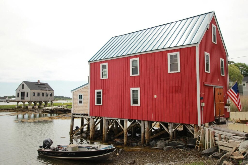
Kennebunk: From Water-Powered Mills to Ships That Sailed the World
It’s hard to imagine when you look at Kennebunk today, but the rivers winding through town once powered an impressive industrial economy.
A sawmill was established on the Mousam River in 1669, followed by other mills along the area’s waterways. Local forests provided abundant timber, and that lumber eventually helped fuel another important industry: shipbuilding.
By the 18th and 19th centuries, Kennebunk was becoming deeply connected to the sea.
In 1790, shipbuilder Tobias Lord began building vessels along the Kennebunk River. Eventually, more than a dozen shipyards operated around what became known as Kennebunk Landing, and builders constructed more than 100 vessels there before the end of the Civil War.
And those weren’t simply small boats cruising the Maine coast.
Kennebunk-built vessels participated in international commerce stretching across the globe. Two locally built ships, the Guatimozin and Atahualpa, were constructed in 1800 for trade voyages involving the Pacific Northwest, Hawaii, and China. The Atahualpa completed a voyage around the world between 1800 and 1803.
Prosperity from shipping and trade helped create the grand homes that still line parts of Kennebunk today. The town’s historic sea captain’s mansions remain one of the most visible reminders of that era.
Even the famous Wedding Cake House became part of Kennebunk’s image. Although the romantic story traditionally attached to its elaborate decoration was apparently a postcard-era invention rather than actual history.
What put Kennebunk on the map?
Timber, mills, shipbuilding, and a maritime economy that connected this small Maine community with ports around the world.
Kennebunkport: Shipbuilding, Sea Captains, and a Presidential Summer Home
Before Kennebunkport became synonymous with vacations, boutiques and Dock Square, it was a working maritime community.
The town traces its formal beginnings to 1653, when Cape Porpoise became an incorporated community. It was later known as Arundel before eventually becoming Kennebunkport.
Like neighboring Kennebunk, its future became tied to shipbuilding.
By the 19th century, shipyards lined sections of the Kennebunk River. The Ward brothers launched the schooner Nile directly from Dock Square in 1841, and shipbuilding continued around the river for generations.
The industry’s scale was remarkable. A newspaper correspondent visiting in 1876 reported seeing nine vessels in various stages of construction in shipyards on both sides of the Kennebunk River.
Eventually, however, tourism began reshaping the community.
Summer visitors arrived for the beaches, ocean air, and grand hotels. Transportation improvements made the Maine coast increasingly accessible, and Kennebunkport gradually developed into the resort community generations of visitors know today.
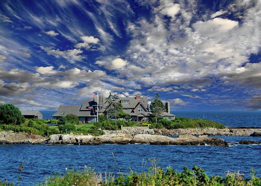
Then came a connection that put the town in the international spotlight: the Bush family and Walker’s Point.
George H.W. Bush, the 41st president of the United States, spent summers at the family’s Kennebunkport property for much of his life. During his presidency and afterward, images of the president boating, fishing, and meeting political leaders in Kennebunkport were seen around the world. His son, President George W. Bush, has also vacationed at the family compound.
Interestingly, the Bush family wasn’t Kennebunkport’s first presidential connection. President James Monroe visited the Kennebunks in 1817 during a tour of New England!
What put Kennebunkport on the map?
First shipbuilding and maritime commerce, then tourism, and eventually one of America’s most recognizable presidential summer homes.
Six Towns, Centuries of Stories
Drive Route 1 through Southern Maine today, and it’s easy to focus on what you see now: restaurants, beaches, shops, galleries, hotels, and busy village centers.
But underneath modern Southern Maine is another landscape entirely.
Kittery helped build America’s naval tradition.
York preserves some of Maine’s earliest colonial history.
Ogunquit became a nationally significant community for artists and theater.
Wells survived decades as a vulnerable frontier settlement before becoming a center of trade and, later, tourism.
Kennebunk built ships that carried people and goods around the world.
And Kennebunkport transformed from a shipbuilding community into an internationally recognized vacation destination.
Perhaps that’s what makes exploring Southern Maine so interesting. The places we visit for lobster rolls, beach days, and weekend getaways aren’t simply picturesque coastal towns.
They’re places where nearly four centuries of Maine history happened, and much of that history is still hiding in plain sight.
The next time you’re walking through Dock Square, exploring Perkins Cove, driving past the Portsmouth Naval Shipyard, or wandering the historic streets of York, take another look around.
You might be standing closer to history than you realize.
Comments